Let’s hear all about You!

What have you been up to?

Don’t you hate that question?  Depending on the person, I always take a moment to reflect on what I have and haven’t been doing.  During this short moment of self-reflection, I have to decide whether or not I should be thinking about what I have done or what I haven’t done.  What is my mood at that particular moment….am I sarcastic? Am I excited?  Depressed?  Is the typical Pacific Northwest mood affecting me?  Is the rain getting me down?  Is my Facebook envy getting the better of me?

Today, I might say:

Well, I haven’t been posting on my blog…

Well, I haven’t been doing as much work on being a passive income (business) like I should….

I haven’t been working on my school photography business like I should…

Or preparing my business documents for my tax accountant like I should….

On the flip side, my positive outlook would make me reply in such a manner that my life is going awesome!

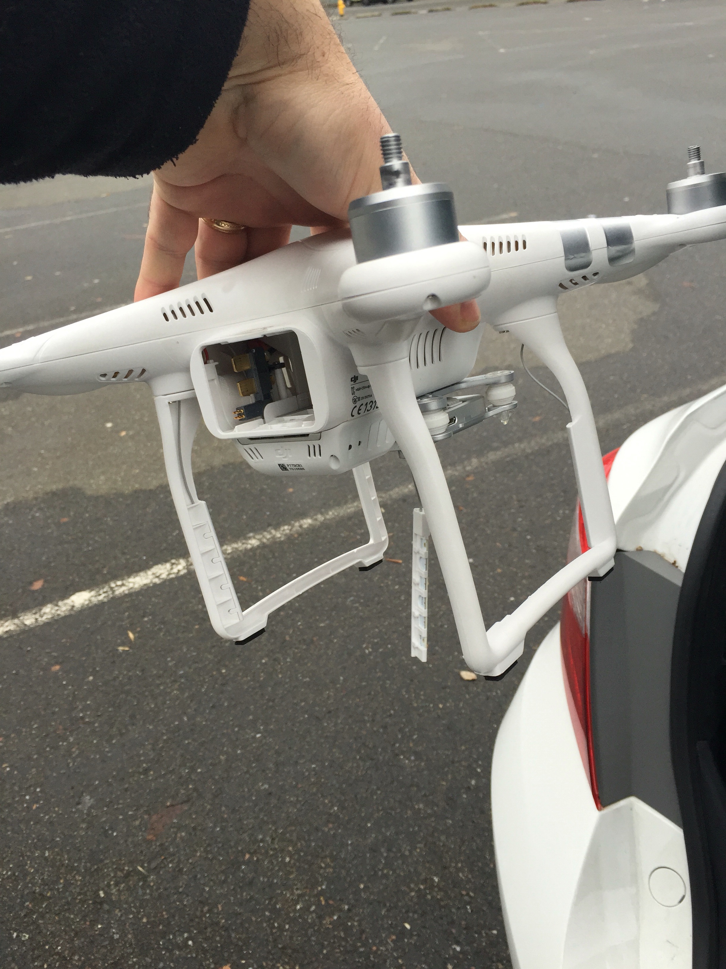
Well, we got our Phantom 3 drone 90% repaired!

I published two blog posts today and I’m on my way to uploading the third.

I finished the novel Doctor Sleep by Stephen King and the other three books I’m reading are holding my interest for the time being.

I’m thinking about writing a science fiction novel or even a romance novel (who careIMG_9082 (1)s that I’m not the least bit romantic…I know my book will be a bestseller!)

And today is actually sunny here in the Seattle area so I’m in a delightful mood.

So…what have you been up to my dear readers?


Phantom 3 Drone Repairs (Update)

About a week and a half ago, I crashed our Phantom 3 drone because I was being stupid.  Needless to say, we ordered replacement parts and my son installed them.  Everything was running but we had some issues with the camera (2.7K camera).  It was a bit slated and it seemed to be getting jammed,  My son’s attempts to correct it failed and I made the executive decision to just go ahead and buy a new camera.  A new camera was ordered and should arrive on Monday.

The other part that was broken was the compass.  This part was replaced fairly easily.  Thank goodness for YouTube and other people flying the Phantom 3, and their repair videos.  YouTube makes life a lot easier for us, don’t you agree?

Here’s the video just before I crashed during a flight over Lake Union.

Drone Crash Update: Replacement Parts have been ordered!

After my drone crash and my son’s lecture to me about proper flying techniques, we assessed the damage and figured out the parts we needed to order.  Prior to my son and I assessing the damage together, I had taken the drone into a local drone shop in Bellevue for some input and assessment.  They seemed pretty knowledgeable and give me a quick assessment.  The motors appear to be OK (I thought so as well).  I wanted my son and I to have the chance to look over the drone together and then make a repair decision.  As you can clearly see from the photos (in my last post), the camera was torn from the gimble (broken yaw arm).  Since the camera is detached from the gimble, the camera cable ribbon is also sheared off and needs replacement.

DJI doesn’t seem to sell just the gimble part to their cameras.  They would like you to replace the camera (ours is the Phantom 3 Advanced model with the 2.7K camera).  Cost of the replacement camera is $409 (not included any taxes or shipping fees).  I found a couple of different suppliers for the yaw arm ($50-$99) on Amazon and Ebay.  I purchased the camera cable ribbon directly from DJI for $35 plus $10 shipping.  I did find that online at other suppliers for cheaper but thought I’d better go with OEM parts for the cable ribbon.

One of the landing gear/skids was cracked but we will glue or use epoxy that together.

The last part I broke (but I think that it may have been broken when my son and this friend were trying to push it back together) was the compass on the Phantom 3.  The compass appears to be in one of the landing skids.  The compass itself wasn’t broken but the small cables were cut in half.  I think they were sliced when my son and his friend tried to push it together.  That cable couldn’t be fixed so I ordered that part as well (roughly $20).

Crash of the Drone

So….

I’ve been practicing my drone flying skills and decided to fly the drone around Lake Union a bit today. I got some nice footage of some boats, saw a sea plane landing, and then managed to crash my drone.  Actually, the drone belongs to my son and myself. As you can imagine, it was hard to tell my business partner I crashed the drone this morning.

I was flying an old ferry boat and got too close to the barge that is docked next to it. I realized that I was too close and attempted to go up which is where I got into trouble.

Once the crash occurred, I pretty much thought my son was going to kill me when he found out. Why bother trying to find it? I was a dead man.

Nevertheless, I threw the controller and the drone backpack into the back of the car and raced to the crash site.  I was pretty sure I wasn’t going to find it or be able to get to it. This is a “working” lake (meaning there are barges, fishing boats, sea planes landing and taking off) in Seattle and the drone was probably at the bottom of the lake.

I did find the drone laying on a barge and was able to recover it.  Below are some photos and the actual drone video crash footage of the damage.

Edit      Edit 


Drone video footage of the ferry “Ocean City” in Oro Bay on Anderson Island, WA

Anderson Island, WA – Drone Footage of ferry boat “Ocean City” in Oro Bay

Enjoy this drone footage of the retired ferry boat “Ocean City” now docked in Oro Bay, Anderson Island, WA.  Oro Bay is located in the southeast section of Anderson Island.  The ferry boat “Ocean City” was actually sailed over from the east coast of the United States via the Panama Canal.

Interested in learning more about the ferry? Click:  “Ocean City” Ferry Boat information

Here is another article (from 1998) from the AP News: Floating RV Park?

A 1993 Seattle Times story: Oro Bay Ferry

Flying the drone on Anderson Island, WA


Snow…but no snow…

Lately, we have been getting some good heavy snowfalls in the mountain regions of the Puget Sound area. Today we were excited to set off for Paradise (Elevation: 5400 feet), on Mt. Rainier, for a play day in the snow. Do some snowshoeing, perhaps even build a snow cave or even an igloo.

The drive to Paradise isn’t too bad if the road is clear. You enter the Mt. Rainier National Park though the Longmire gate entrance.  However, with the recent snowfall, and then having the temperatures rise back up a bit, plus you add some rain and you have a great situation for avalanches. The park service is pretty good at keeping the road closed if it should be closed (due to dangerous conditions).  The National Park Service (NPS) also requires you to have tire chains even if you have a vehicle with all wheel drive or four wheel drive.

We were just outside of Elbe, when we decided we had better check the National Park Service’s Twitter feed and discovered that the road to Paradise from Longmire was closed. Oh well.  Drive an hour or so to discover you can’t get into Rainier National Park.  But then again, that is the nature of winter weather.

We are hoping to return to Mt. Rainier National Park over the next few weeks if possible. 


New Drone Video Footage of Anderson Island, WA

This past weekend, my son and I took a quick trip to Anderson Island to fly the Phantom 3 drone and get some awesome raw footage.  We did three flights and the video below is a short video of those flights.

On a side note, for us to keep the YouTube channel name “Seattle Drones”, we need at least 100 subscribers.  Do us a favor and hit the “subscribe” button when you view the video.  And we need you to “like” this video too!  Heck, you should post it on your Facebook page and email all your friends about this video!

Anderson Island is located in the south Puget Sound area of Washington State and is accessible by ferry boat, boat, or helicopter.  You could also land a seaplane or parachute in if you like.  I’ll stick to the ferry boat ride (I don’t jump out of perfectly good aircraft) and using the drone (or an airplane) for bird’s eye views of Anderson Island.

During the drone video, you’ll see one of the two ferries that Pierce County operates between Steilacoom (mainland) and Anderson Island.  My son Hayden ran the drone from the parking lot near the ferry landing on Anderson Island.  He doesn’t seem to trust me with flying it at this point.

The lake portion of the video is Lake Josephine with views east towards Mt. Rainier.  You can also see Oro Bay during this section of the video and we launched from Ray Park.

The third and final part of the video shows McNeil Island to the north, Eagle Island (a Washington State Park – day use only), some more of the ferry, and a gorgeous sunset with the Olympic Mountains in the distance.  We launched from Olso Point for this flight.

Below are some helpful links if you are interested in a visit to Anderson Island:

Ferry Schedule for Anderson Island Ferry

Anderson Island Information

Join our Seattle Drone Twitter Feed: Seattle Drones


Drone footage of the Seattle Christmas Ships on Lake Union

My son and I purchased a drone back in September and he has put together a few videos of his recent flights. He is building up his YouTube channel subscribers. An important side note: to keep your YouTube channel “name” you need at least 100 subscribers.  So, I’m hoping you’ll take a moment to subscribe to his channel so he can reach 100 subscribers.

And if you have the time, please like the channel/video and leave a comment if you can.

Click on this link:

Seattle Christmas Ships on Lake Union drone footage
Or cut and paste: http://youtu.be/fPb66hf7HTI

I would have inserted the video into this post but it is from my iPhone and I’m not quite sure how to do it. Sorry!