The semester ended for our kids this past Monday so the whole school district has to let the kids off for the day. I’m not sure if my kids really go to school for a full five days in a row. What, with all the holidays, late start days, etc. my kids never seem to go to school for a full week.

However, we aren’t here to complain about the state of our education system. Instead we are here to chat about another great little hike here in the Seattle area. It is the Twin Falls Hike off of I-90 in the North Bend area. This is a short hike coming in at only two miles round trip.
Of all the years I have live here, I have never done this hike. With all of this great winter weather we have been having lately, I thought we should take advantage of going on an easy hike during the “off season” of hiking. (Die hard hikers would say there is never an “off season”). From what I have read about this hike, it is a fairly popular hike especially during the summer. Consider it is January and we usually have a bunch of rain, I figured this is as a good time as any to do this hike.
Luckily, I checked the trail report at wta.org and learned that there was a washout on the trail to the Twin Falls. This would stop is if we left from the traditional trailhead off of Exit 34. Good thing I check it out before we started our hike. The Wta.org website is an excellent resource for all hikes in Washington State and I highly recommend checking it out before any hike.
We modified our starting point to the Ollalie State Park parking lot off of Exit 38. You start your hike on the Iron Horse Trail for about half a mile until you come to the spur/trail to the Twin Falls trail. The Iron Horse Trail is an old Burlington Northern railroad bed (now a service road) so the downhill grade is mild for about half a mile. The trail to Twin Falls is clearly marked (from the Iron Horse Trail) and you won’t miss it (unless your face is buried in your phone texting a friend).
After you leave the Iron Horse Trail and use the Twin Falls Trail, you will be going downhill for about 3/4 of a mile. Just remember, you will be going down and that means the way back is uphill.
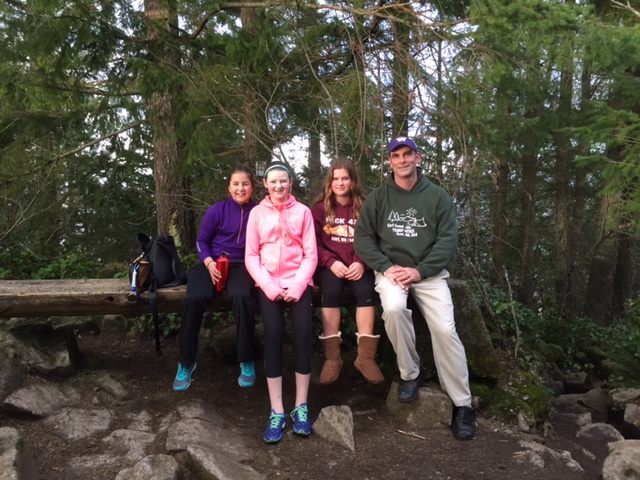
Easy trail down for my hiking partners and myself. In our hiking band, we had my wife, my daughter, and another Girl Scout (and friend) with us. No one complained about the hike so that means it is a fairly easy one for 12 year old girls and 40 year old parents.
For all you math geeks, the different route brings this hike in at 2.5 miles.

Overall, this hike is a good family hike and easy to do. We left the Covington area around 2 pm and we’re back to Covington by 5 pm. That included a stop at McDonalds for hot fudge sundaes (for the girls). Hey, I’m working out so I can win the Fat Ass Dads Weight Loss Challenge so I’m skipping that stuff. Well, until I get home…then I pig out and cry into my bowl of chocolate peanut ice cream….
At least Cyndi (my imaginary stalker) cares….